News |
Community flood markers: a vital tool to protect populations from flooding
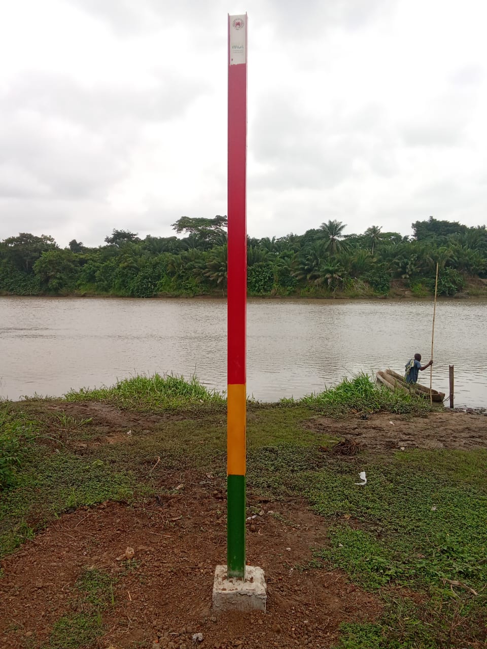
Reducing flood risks is one of the priority areas of intervention under the WACA projects. In this context, 31 community flood markers have been provided to the National Civil Protection Agency (ANPC) and installed in several localities downstream of the Mono River. Their purpose is to enable communities to monitor rising water levels in real time and take rapid safety measures when needed.
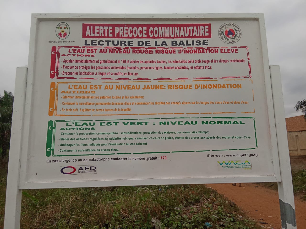
Before each installation, extensive awareness-raising campaigns are conducted with local populations. These sessions, led by Red Cross teams, aim to explain how the markers work and to strengthen risk awareness within the villages concerned.
The markers are designed as cement pillars divided into three color-coded zones—green, yellow and red—that are easy for residents to understand:
- Green level: normal conditions; river crossings and daily activities can continue safely.
- Yellow level: increasing risk of flooding; heightened vigilance is required.
- Red level: alerts are activated and evacuations must be carried out to protect lives and property.
Thanks to these community markers, populations living in the most flood-prone areas now have access to a simple, reliable and accessible early warning system, helping them anticipate rises in the Mono River and significantly reduce the impacts of flooding.