Mauritania
Capital: Nouakchott
Total Population: 4.3 million
Coastline: 754 km
Toolkit%20Waca%20Mauritania.pdf
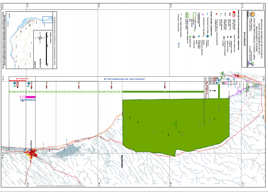
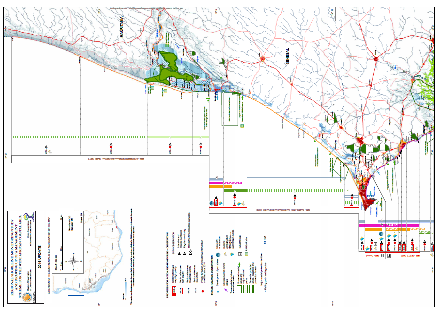
Coastal Zone of Mauritania
The coastal zone varies between high energy beaches in the north to mangrove environment at the Senegal River mouth. The sandy islands of the Banc d’Arguin is a significant habitat for migrating birds. The coastline is interrupted my infrastructure such as the Nouakchott port. In the north, a the bay of Nouadhibou forms a natural harbor for the city’s free-zone economy. Parts of Nouakchott is under sea-level level, vulnerable to floods, and protected from the Atlantic Ocean by just a string of dunes and adds to the new development challenges of the countries. Detailed information on Mauritania’s coast is provided here.
Action Planning
Mauritania has developed a 2018-2022 Coastal Master Plan to address climate change and associated risks. The plan takes a spatial approach to coastal zone development and includes an overall climate adaptation and risk reduction approach, as well as sectoral approaches for fisheries, meteorology and hydrology. The plan also includes actions on information management, governance, legal reforms, and a Multi-Sector Investment Plan (MSIP).
WACA Interventions
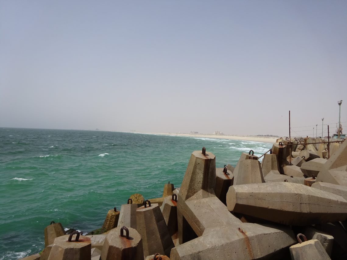
One of the priority interventions is the reinforcement of coastal dunes that protects Nouakchott. This is done by sand replenishment and by fixating the sand using vegetation, combined with managing access to the dunes to prevent their destruction. In the Diawling National Park, one of the existing dikes will be extended and rehabilitated to increase its risk reduction capacity. In the cross-border area with Senegal, mangroves will be planted to act as a buffer to fight the erosion of the shoreline of the Senegal River mouth. Support is underway for the feasibility of cross-border artificial beach replenishment. In addition, community-based disaster risk reducing measures will be financed, as will the preparation of long-term resilience and adaptation plans for local communities in Ndiago, a small village affected by coastal erosion in the south. Finally, at la Baie de l’Étoile, a rich yet fragile ecosystem located north of Nouadhibou, will be protected through better land management leading to a protected areas status, and though promotion of ecotourism for biodiversity protection.
Key agencies
The Ministry of Environment and Sustainable Development is the lead agency for the coastal resilience efforts. It has established a project implementation unit to coordinate project activities supported by multiple partners.
Contact
Mauritania is seeking partners with resources available to scale up support on coastal resilience. WACA Coordinator for Mauritania is Pr. Mohamed Lemine.