Sao Tome and Principe
Capital: São Tomé
Total Population: 200,000
Coastline: 209 km around a land area of 1,001 km2
Coastal Zone of Sao Tome and Principe
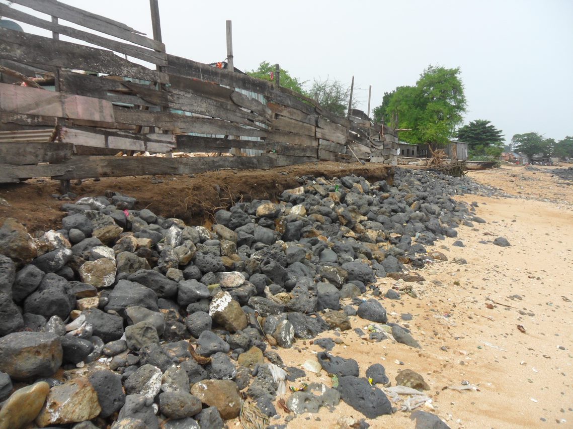
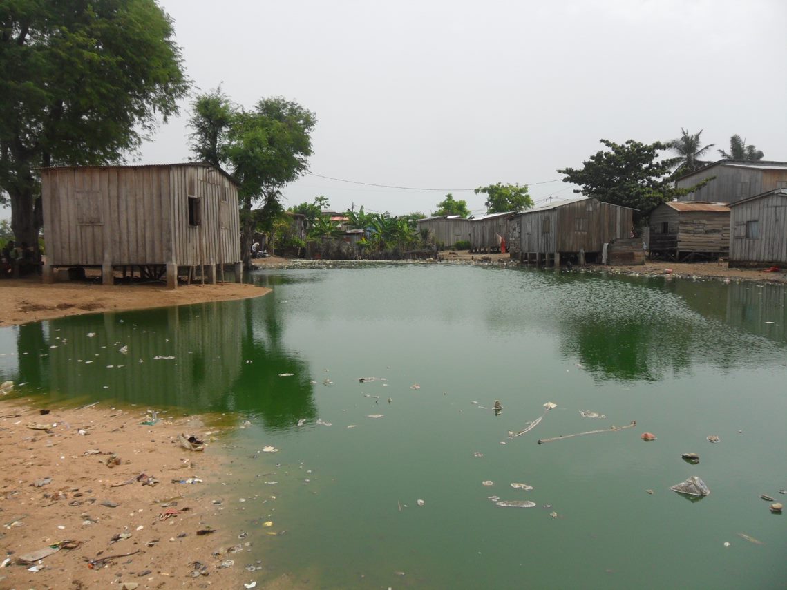
The country consists of an archipelago with two main islands, São Tomé Island which is 50 km long and 30 km wide, and Príncipe Island which is about 30 km long and 6 km wide. The coastal zone includes the slopes of extinct volcanoes, within which the environment is under stress from soil degradation and coastal erosion.
Action Planning
A Multi-Sector Investment Plan (MSIP) was developed for the country which emphasized the need for policy reforms that promote more sustainable and adaptive management of the coastal zones, a new institutional framework for disaster risk management, and a strong community engagement for coastal protection.
WACA Interventions
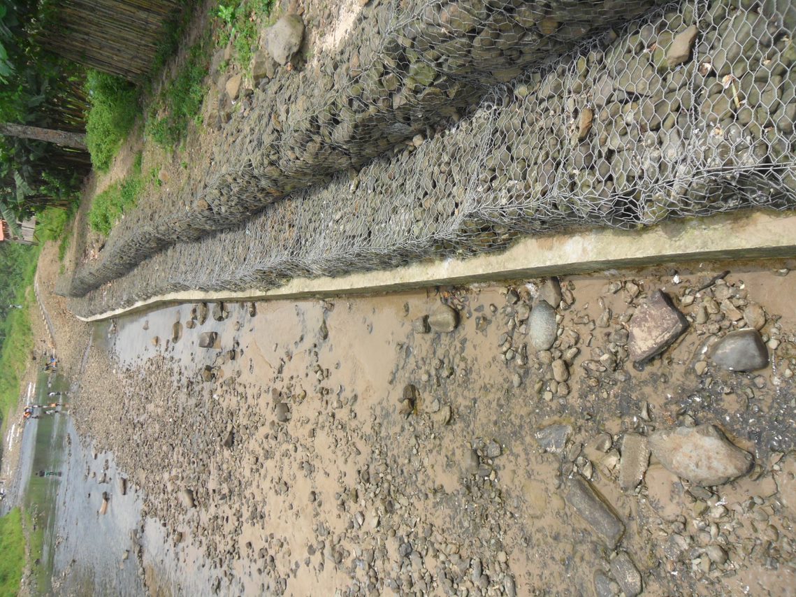
Ongoing activities focus on natural-based solutions through community approaches and hybrid solutions, when hard solutions are indispensable, beach nourishment, drainage, breakwaters, and coastal and river bank revetments. On policy interventions, a new law on sand extraction is being supported. Community-based adaptation is a center of the approach in Sao Tome and Principe, including support to schemes for routine maintenance of coastal protection infrastructure in collaboration with district governments.
Key agencies
The Ministry of Infrastructure, Natural Resources and Environment is the lead agency for the coastal resilience efforts. It has established a project implementation unit to coordinate project activities supported by multiple partners.
Contact
São Tomé and Príncipe is seeking partners with resources available to scale up support on coastal resilience. WACA Coordinator for São Tomé and Príncipe is Arlindo DE CARVALHO.
Congratulations to Sao Tome for the Board-Approval of $6million GEF Additional Financing
This AF aims to scale-up the development impact of the parent project in São Tomé and Príncipe by implementing activities embedded and envisaged in the planning phase of the Parent Project, but not yet financed.
The Parent project, WACA ResIP, emphasizes the development of safer relocation areas to provide incentives for the population not to settle in the most at-risk areas, but additional investments are needed to restore the natural ecosystems so that they could play their original role of adaptative protection from tides, surges and sea-level-rise; and to develop them to promote community-based sustainable income generating activities, such as tourism and sustainable fisheries.
As designed, activities under this AF will scale-up risk mitigation and adaptation measures from eight[1] to 12 of the most vulnerable communities following the Parent Project participatory approach. Activities under the AF will complement planned relocation with scaled-up risk mitigation measures and ensure that the to-be vacated areas are properly planned to ensure their long-term sustainability and avoid future re-settlements in these as risk areas. The process of helping the pilot communities expand into safer areas may be shortchanged if the to-be voluntary vacated areas would not be restored and properly planned and used for sustainable and resilient uses. Also, additional adaptation measures will be needed to protect the rest of the communities, to the threat of climate change, through improvement of the drainage system.
The AF would also help to improve the early warning and safety at sea amongst artisanal fishers, and thus ensure that lives can continue to be saved over the long term. Principles of safety at sea would have been introduced amongst part of the coastal fishermen - with an immediate observable impact - but with uncertain sustainability due to the time required to change risk behavior. The AF will also expand the outreach of the safety at sea program from 1750 to now 4,155 artisanal fishers (all identified artisanal fishermen in the country) and improve the early warning system component of the project by complementing the weather forecast with two additional marine meteorological stations.
Given that such activities represent a natural complement to the parent Project WACA-ResIP activities, AF seems the most appropriate option to maximize development outcomes. The project will enable a faster and more cost-effective response to the client’s request to sustain and scale-up the results. The responsible agency, Directorate General of Environment, Ministry of infrastructure, Public Work, Natural Resource and Environment, has demonstrated its strong commitment, and has proved to be a competent counterpart agency, as shown by the initial project’s satisfactory track records. There would be no change to the key implementation arrangements put in place.
The eight communities included the four communities from the previous Adaptation project (P111669): Malanza, Santa Catarina, Ribeira Afonso and Praia Burra, as well as four new ones: Io Grande, Praia Melão, Micolo and Praia Abade. The additional financing will include also Pantufo, Praia Gamboa, Praia Lochinga and Praia Cruz.